 Location:
The southwest slope of Apache Mountain, on National Forest System Lands, Quemado Ranger District, Gila National Forest, Catron County, NM
Incident Start Date: September 4, 2019 Size: 180 acres Cause: Lightning
Percent Contained: 0 IC: J. Gutierrez, ICT5
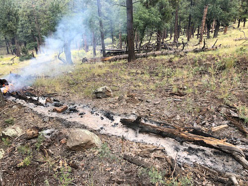
Summary: The Apache Fire was reported on Wednesday, September 4. It is located on the southwest slope of Apache Mountain, at approximately 8,500 feet elevation. The fire is located in very steep, 90-100% slope, inaccessible terrain. The fire is minimal and there are some smoldering stumps and heavy dead/down timber. The fire has received significant precipitation over the past week, with cooler weather and occasional precipitation predicted. Due to the decreased activity, the fire has transitioned from a Type 4 incident to a Type 5 incident and monitoring will continue.
Minimal smoke may continue to be visible. Smoke from fire rises during the daytime, but in the evening can pool down in canyons, drainages, and basins. For information on air quality and protecting your health, and to find guidance on distance and visibility, please visit https://nmtracking.org/environment/air/FireAndSmoke.html.
For information on the Gila National Forest, check out our website at https://www.fs.usda.gov/gila