 This weather alert has been CANCELLED.
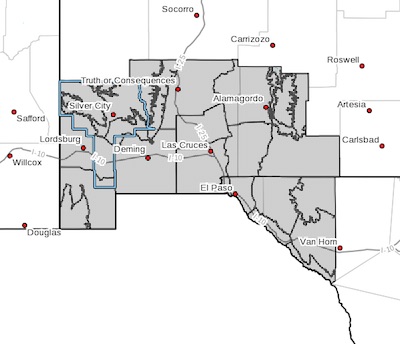
Upper Gila River Valley-Southern Gila Highlands/Black Range- Southern Gila Foothills/Mimbres Valley-
Southwest Desert/Lower Gila River Valley-Lowlands of the Bootheel- Uplands of the Bootheel-Southwest Desert/Mimbres Basin-Eastern Black Range Foothills-Sierra County Lakes-Northern Dona Ana County-Southern Dona Ana County/Mesilla Valley-Central Tularosa Basin-Southern Tularosa Basin-West Slopes Sacramento Mountains Below 7500 Feet-Sacramento Mountains Above 7500 Feet-
East Slopes Sacramento Mountains Below 7500 Feet-Otero Mesa-Western El Paso County-Eastern/Central El Paso County-Northern Hudspeth Highlands/Hueco Mountains-Salt Basin-Southern Hudspeth Highlands-Rio Grande Valley of Eastern El Paso/Western Hudspeth Counties-
Rio Grande Valley of Eastern Hudspeth County-
Including the cities of Cliff, Buckhorn, Gila Hot Springs,
Mule Creek, Silver City, Lake Roberts, Kingston, Fort Bayard, Mimbres, Hurley, Faywood, Grant County Airport, Lordsburg,
Red Rock, Virden, Antelope Wells, Animas, Hachita, Cloverdale,
Deming, Columbus, Hillsboro, Winston, Truth Or Consequences,
Derry, Spaceport, Garfield, Hatch, Radium Springs, Las Cruces,
Vado, Sunland Park, Alamogordo, Tularosa, White Sands Monument,
Chaparral, Orogrande, White Sands Range Headquarters, Mescalero,
Timberon, Mountain Park, Cloudcroft, Sunspot, Apache Summit,
Mayhill, Pinon, Sacramento, Crow Flats, Downtown El Paso,
West El Paso, Upper Valley, East and Northeast El Paso, Socorro,
Fort Bliss, Hueco Tanks, Loma Linda, Cornudas, Dell City,
Salt Flat, Sierra Blanca, Fabens, Fort Hancock, Tornillo,
and Indian Hot Springs
307 AM MDT Wed Mar 14 2018
...WIND ADVISORY IN EFFECT FROM NOON TO 8 PM MDT THURSDAY...
The National Weather Service in El Paso Tx/Santa Teresa has
issued a Wind Advisory, which is in effect from noon to 8 PM MDT
Thursday.
* TIMING...Winds will increase during the late morning and early
afternooon with maximum speeds between 3 PM and 6 PM.
* WINDS...Sustained wind speeds will be around 30 mph with gusts
to 50 mph most areas. However gusts around 60 mph may occur
over the higher mountains and along eastern slopes.
* IMPACTS...The winds will create hazardous driving conditions
especially for high profile vehicles. Blowing dust will lower
the visibility to under a mile over a few locations including
portions of Interstate 10 between El Paso and Las Cruces and
also around Deming and Lordsburg making driving especially
dangerous. The winds may also cause minor property damage.
PRECAUTIONARY/PREPAREDNESS ACTIONS...
A Wind Advisory means that winds of 35 mph are expected. Winds
this strong can make driving difficult, especially for high
profile vehicles. Use extra caution.