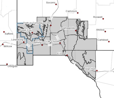
 Upper Gila River Valley-Southern Gila Highlands/Black Range-Southern Gila Foothills/Mimbres Valley-Southwest Desert/Lower Gila River Valley-Lowlands of the Bootheel-Uplands of the Bootheel-Southwest Desert/Mimbres Basin-Eastern Black Range Foothills-Sierra County Lakes-Northern Dona Ana County-Southern Dona Ana County/Mesilla Valley-Central Tularosa Basin-Southern Tularosa Basin-West Slopes Sacramento Mountains Below 7500 Feet-Sacramento Mountains Above 7500 Feet-East Slopes Sacramento Mountains Below 7500 Feet-Otero Mesa-Western El Paso County-Eastern/Central El Paso County-Northern Hudspeth Highlands/Hueco Mountains-Salt Basin-Southern Hudspeth Highlands-Rio Grande Valley of Eastern El Paso/Western Hudspeth Counties-Rio Grande Valley of Eastern Hudspeth County-Including the cities of Cliff, Buckhorn, Gila Hot Springs, Mule Creek, Silver City, Lake Roberts, Kingston, Fort Bayard, Mimbres, Hurley, Faywood, Grant County Airport, Lordsburg, Red Rock,
Virden, Antelope Wells, Animas, Hachita, Cloverdale, Deming, Columbus, Hillsboro, Winston, Truth Or Consequences, Derry, Spaceport, Garfield, Hatch, Radium Springs, Las Cruces, Vado, Sunland Park, Alamogordo, Tularosa, White Sands Monument, Chaparral, Orogrande, White Sands Range Headquarters, Mescalero, Timberon, Mountain Park, Cloudcroft, Sunspot, Apache Summit, Mayhill, Pinon, Sacramento, Crow Flats, Downtown El Paso, West El Paso, Upper Valley, East and Northeast El Paso, Socorro, Fort Bliss, Hueco Tanks, Loma Linda, Cornudas, Dell City, Salt Flat, Sierra Blanca, Fabens, Fort Hancock, Tornillo, and Indian Hot Springs
130 PM MDT Tue Apr 10 2018
...HIGH WIND WATCH IN EFFECT FROM THURSDAY MORNING THROUGH
THURSDAY EVENING...
The National Weather Service in El Paso Tx/Santa Teresa has
issued a High Wind Watch, which is in effect from Thursday
morning through Thursday evening.
* TIMING...Winds will increase so that by late morning we will
begin to see the stronger winds. The strongest winds will occur
during the afternoon hours and then begin to slow a little after
midnight
* WINDS...Winds of 35 to 45 mph with gusts to 65 mph will be
possible.
* IMPACTS...Hazardous driving conditions due to strong gusts will
affect north/south routes with dangerous cross winds. Blowing
dust will reduce visibilities in some areas to near zero. Damage
to structures, signs, and trees is also possible. Wildfire and
brush fire danger will be critical so caution required with
outdoor flames and sparks.
PRECAUTIONARY/PREPAREDNESS ACTIONS...
A High Wind Watch means there is the potential for a hazardous
high wind event. Sustained winds of at least 40 mph, or gusts of
58 mph or stronger may occur. Continue to monitor the latest
forecasts.