 Lowlands of the Bootheel-Uplands of the Bootheel-
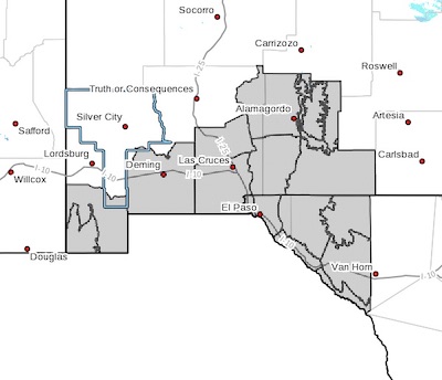
Southwest Desert/Mimbres Basin-Northern Dona Ana County-
Southern Dona Ana County/Mesilla Valley-Central Tularosa Basin-
Southern Tularosa Basin-
West Slopes Sacramento Mountains Below 7500 Feet-
Sacramento Mountains Above 7500 Feet-
East Slopes Sacramento Mountains Below 7500 Feet-Otero Mesa-
Western El Paso County-Eastern/Central El Paso County-
Northern Hudspeth Highlands/Hueco Mountains-Salt Basin-
Southern Hudspeth Highlands-
Rio Grande Valley of Eastern El Paso/Western Hudspeth Counties-
Rio Grande Valley of Eastern Hudspeth County-
Including the cities of Antelope Wells, Animas, Hachita,
Cloverdale, Deming, Columbus, Garfield, Hatch, Radium Springs,
Las Cruces, Vado, Sunland Park, Alamogordo, Tularosa,
White Sands Monument, Chaparral, Orogrande,
White Sands Range Headquarters, Mescalero, Timberon,
Mountain Park, Cloudcroft, Sunspot, Apache Summit, Mayhill,
Pinon, Sacramento, Crow Flats, Downtown El Paso, West El Paso,
Upper Valley, East and Northeast El Paso, Socorro, Fort Bliss,
Hueco Tanks, Loma Linda, Cornudas, Dell City, Salt Flat,
Sierra Blanca, Fabens, Fort Hancock, Tornillo,
and Indian Hot Springs
416 AM MDT Wed Apr 3 2019
...WIND ADVISORY IN EFFECT FROM NOON TODAY TO 8 PM MDT THIS
EVENING...
The National Weather Service in El Paso Tx/Santa Teresa has
issued a Wind Advisory, which is in effect from noon today to
8 PM MDT this evening.
* TIMING...Winds will increase by this afternoon and continue into
the evening hours to around sunset.
* WINDS...Wind speeds of 25 to 35 mph with gusts to 45 mph will be
possible by late this afternoon.
* IMPACTS...Strong cross winds across major roads and highways
will create difficult driving conditions for high profile
vehicles. Patchy blowing dust may also reduce visibilities,
especially in the dust prone regions west of Las Cruces. In
addition, small loose objects outside may be blown around.
PRECAUTIONARY/PREPAREDNESS ACTIONS...
A Wind Advisory means that winds of 35 mph are expected. Winds
this strong can make driving difficult, especially for high
profile vehicles. Use extra caution.