


Weather
High Wind Warning 041524
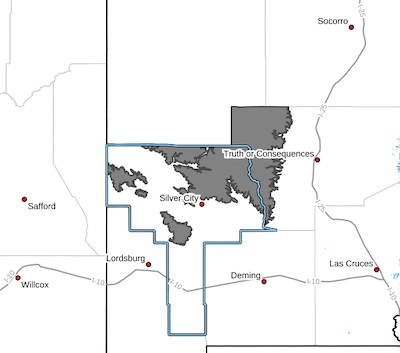
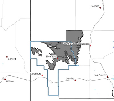 Central Grant County/Silver City Area-Southern Gila Region
Highlands/Black Range-
Including the cities of Lake Roberts, Kingston, Silver City,
Mimbres, and Fort Bayard
1226 PM MDT Sat Apr 13 2024
...HIGH WIND WARNING IN EFFECT FROM 1 PM TO 10 PM MDT MONDAY...
* WHAT...West winds 35 to 45 mph with gusts up to 60 mph with up to
70 MPH within the Black Range.
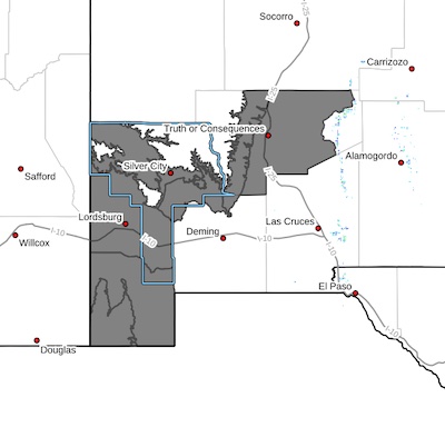
Wind Advisory -2 -041524
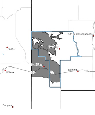 Upper Gila River Valley-Southwest Desert/Lower Gila River Valley-
Including the cities of Gila Hot Springs, Red Rock, Lordsburg,
Cliff, Buckhorn, Mule Creek, and Virden
1226 PM MDT Sat Apr 13 2024
...WIND ADVISORY IN EFFECT FROM 1 PM TO 10 PM MDT MONDAY...
* WHAT...West winds 30 to 40 mph with gusts up to 55 mph expected.
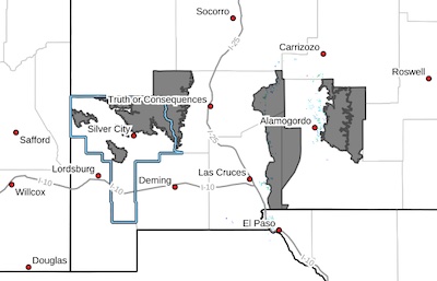
Fire Weather Watch 041524
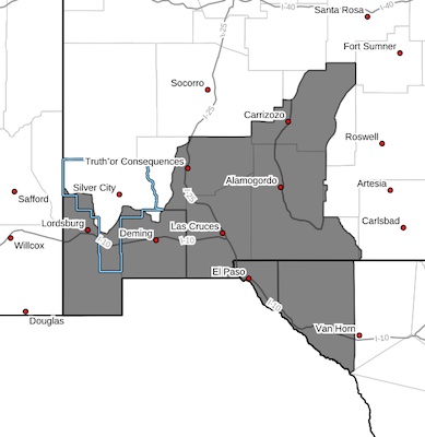 CRITICAL FIRE CONDITIONS EXPECTED MONDAY... .A strong upper low will be moving into the Four Corners region on Monday which will bring strong west to southwest winds to the Borderland. Winds gusting to 60 mph combined with minimum relative humidities in the single digits will lead to extremely critical fire weather conditions late Monday morning into the evening.
Southwest Deserts and Lowlands/Las Cruces BLM/GLZ-
South Central Lowlands and Southern Rio Grande Valley/BLM/GLZ-
Capitan and Sacramento Mountains/Lincoln NF/LNZ-
Texas Fire Weather Zone 055
El Paso County- Texas Fire Weather Zone 056
Hudspeth County-
High Wind Watch 041524
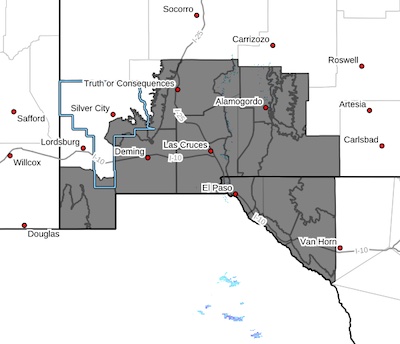 Southern Gila Foothills/Mimbres Valley-Lowlands of the Bootheel-
Uplands of the Bootheel-Southwest Desert/Mimbres Basin-Eastern
Black Range Foothills-Sierra County Lakes-Northern Dona Ana
County-Southern Dona Ana County/Mesilla Valley-West Slopes
Sacramento Mountains Below 7500 Feet-Sacramento Mountains Above
7500 Feet-East Slopes Sacramento Mountains Below 7500 Feet-Otero
Mesa-West Central Tularosa Basin/White Sands-
Wind Advisory - 2- time and area extended 0405-040624
 Southern Gila Region Highlands/Black Range-
Including the cities of Kingston and Lake Roberts
949 PM MDT Thu Apr 4 2024
...WIND ADVISORY IN EFFECT FROM NOON FRIDAY TO 6 AM MDT SATURDAY...
...HIGH WIND WARNING NOW IN EFFECT FROM 6 AM TO 6 PM MDT SATURDAY...
* WHAT...For the Wind Advisory, southwest winds 30 to 40 mph with
gusts up to 55 mph expected. For the High Wind Warning, west winds
30 to 40 mph with gusts up to 60 mph expected.
Wind advisory time and area extended 0405-040624
 Upper Gila River Valley-Southern Gila Foothills/Mimbres Valley-
Southwest Desert/Lower Gila River Valley-Lowlands of the Bootheel-
Uplands of the Bootheel-Eastern Black Range Foothills-Sierra
County Lakes-Central Grant County/Silver City Area-
Including the cities of Cloverdale, Spaceport, Mule Creek,
Faywood, Cliff, Grant County Airport, Lordsburg, Buckhorn, Red
Rock, Truth Or Consequences, Hillsboro, Animas, Mimbres, Fort
Bayard, Silver City, Gila Hot Springs, Hurley, Derry, Hachita,
Virden, Winston, and Antelope Wells
High Wind Warning 040624
 Sacramento Mountains Above 7500 Feet-East Slopes Sacramento
Mountains Below 7500 Feet-Southern Gila Region Highlands/Black
Range-West Central Tularosa Basin/White Sands-
Including the cities of Sunspot, Kingston, Cloudcroft,
Sacramento, Pinon, Mayhill, White Sands National Park, White
Sands Range Headquarters, Chaparral, Lake Roberts, and Apache
Summit
NM 211 in Cliff Area has water running across roadway
ROAD ADVISORY
FLOODING – Cliff/Gila Area
NM 211 "Bear Creek" at milepost 3.5(Gila) has water running over the roadway at low water crossings, roadway is still passable. When the roadway is flooded do not cross and seek an alternate route. NMDOT is currently monitoring and will notify as conditions change.