 CRITICAL FIRE WEATHER CONDITIONS FOR MUCH OF SOUTHERN NEW MEXICO AND FAR WEST TEXAS WEDNESDAY... .A passing upper level trough will lead to increasing dryness and strong winds on Wednesday. Sustained winds will approach 25 to 35 MPH for much of the area, with gusts around 45 MPH common. The strongest winds will favor along and east of the Sacramento Mountains, where gusts could reach upwards of 60 MPH. This will combine with minimum relative humidity in the low double digits and teens in the afternoon, creating high fire danger.
Southwest Deserts and Lowlands/Las Cruces BLM/GLZ-
South Central Lowlands and Southern Rio Grande Valley/BLM/GLZ-
Capitan and Sacramento Mountains/Lincoln NF/LNZ-
Texas Fire Weather Zone 055
El Paso County- Texas Fire Weather Zone 056
Hudspeth County-
437 AM MST Mon Feb 16 2026
...FIRE WEATHER WATCH IN EFFECT FROM WEDNESDAY MORNING THROUGH
WEDNESDAY AFTERNOON DUE TO LOW HUMIDITY AND STRONG WINDS FOR MOST
OF THE SOUTHERN NEW MEXICO AND FAR WEST TEXAS...
The National Weather Service in El Paso Tx/Santa Teresa has
issued a Fire Weather Watch for critical fire weather conditions,
which is in effect from Wednesday morning through Wednesday
afternoon.
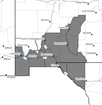
* AFFECTED AREA...Fire Weather Zone 055 Texas Fire Weather Zone
055 El Paso County, Fire Weather Zone 056 Texas Fire Weather
Zone 056 Hudspeth County, Fire Weather Zone 111 Southwest
Deserts and Lowlands/Las Cruces BLM/GLZ, Fire Weather Zone 112
South Central Lowlands and Southern Rio Grande Valley/BLM/GLZ
and Fire Weather Zone 113 Capitan and Sacramento
Mountains/Lincoln NF/LNZ.
* TIMING...11 AM to 6 PM Wednesday
* WINDS...Southwest 25 to 35 mph with gusts up to 50 mph.
* RELATIVE HUMIDITY...As low as 12 percent.
* TEMPERATURES...Up to 69.
* IMPACTS...Any fires that develop will likely spread rapidly.
Outdoor burning is not recommended
PRECAUTIONARY/PREPAREDNESS ACTIONS...
A Fire Weather Watch means that critical fire weather conditions
are forecast to occur. Listen for later forecasts and possible
Red Flag Warnings.