 CRITICAL FIRE WEATHER CONDITIONS POSSIBLE SUNDAY... .Much drier air is moving into the Borderland ahead of an upper level trough. This dry air combined with temperatures into the upper 80s to lower 90s will lead to RH's into the single digits. Winds will be on the increase to 20 to 30 mph to create critical fire weather conditions.
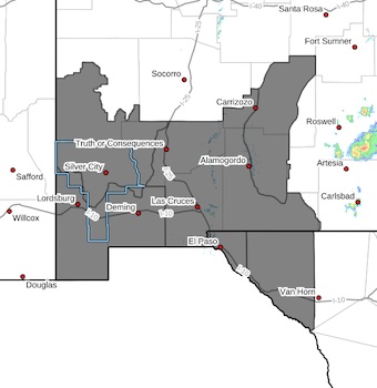
Southwest Mountains/Gila NF/Apache NF/GLZ-
Southwest Deserts and Lowlands/Las Cruces BLM/GLZ-
South Central Lowlands and Southern Rio Grande Valley/BLM/GLZ-
Capitan and Sacramento Mountains/Lincoln NF/LNZ-
Texas Fire Weather Zone 055
El Paso County- Texas Fire Weather Zone 056
Hudspeth County-
1024 AM MDT Fri May 15 2026
...FIRE WEATHER WATCH IN EFFECT FROM SUNDAY AFTERNOON THROUGH
SUNDAY EVENING FOR STRONG WINDS AND LOW RELATIVE HUMIDITIES FOR
FIRE WEATHER ZONES 055, 056, 110, 111, 112, AND 113...
The National Weather Service in El Paso Tx/Santa Teresa has
issued a Fire Weather Watch, which is in effect from Sunday
afternoon through Sunday evening.
* AFFECTED AREA...Fire weather zones 110, 111, 112, and 113.Fire
weather zones 055 and 056.
* WIND...West-southwest at 15 to 30 mph.
* HUMIDITY...5 to 10 percent lowlands, 7 to 13 percent mountains.
* HIGHEST THREAT...is located over the lowlands along and west of
the Rio Grande Valley.
* EXPERIMENTAL RFTI...4 to 5.
* IMPACTS...any fires that develop will likely spread rapidly.
Outdoor burning is not recommended.
PRECAUTIONARY/PREPAREDNESS ACTIONS...
A Fire Weather Watch means that critical fire weather conditions
are forecast to occur. Listen for later forecasts and possible
Red Flag Warnings.