

 Click to Search
Search
{{#data.error.root_cause}}
{{/data.error}}
{{^data.error}}
[{{{type}}}] {{{reason}}}
{{/data.error.root_cause}}
{{#data.hits.hits}}
{{#_source.featured}}
FEATURED
{{/_source.featured}}
{{#_source.showImage}}
{{#_source.image}}
 {{/_source.image}}
{{/_source.showImage}}
{{/_source.image}}
{{/_source.showImage}}
{{/data.hits.hits}}
{{{_source.title}}} {{#_source.showPrice}} {{{_source.displayPrice}}} {{/_source.showPrice}}
{{#_source.showLink}} {{/_source.showLink}} {{#_source.showDate}}{{{_source.displayDate}}}
{{/_source.showDate}}{{{_source.description}}}
{{#_source.additionalInfo}}{{#_source.additionalFields}} {{#title}} {{{label}}}: {{{title}}} {{/title}} {{/_source.additionalFields}}
{{/_source.additionalInfo}}

Latest News


Subscribe to the Update
- Category: Front Page News
The Gila National Forest is planning to enact Stage 1 Restrictions on March 23. The decision was made based on several factors including; long term severe drought in the Gila region, increased tree mortality across the forest due to drought and insects and forecasted weather patterns which indicate higher temperatures and drier conditions for March through June.
Stage 1 Restrictions limit public campfires to designated campgrounds with adequate fire rings to limit potential for human caused wildfires. Several large fires in the Gila National Forest have been caused by humans including the Black Fire of 2022 which burned over 300,000 acres.
- Category: Front Page News
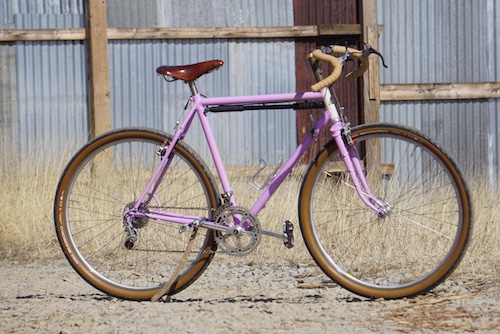
Added Incentive to Register for Tour of the Gila Presented by New Mexico True
Monē Bikes Frameset To Be Raffled to Amateur Competitor in the Iconic Stage Race
Silver City, NM — In 2026, Tour of the Gila presented by New Mexico True will again raffle a Monē Bikes frameset to one lucky competitor in any of the five USA Cycling races. Every person who registers and shows up at the start line of the three- or four-day race is automatically entered to win.
Teenage athlete Sterling Smith's name got drawn in the raffle for a Monē Bikes Hachita frame on the day of the 2025 Downtown Silver City Criterium. "It was the best thing I've ever won and the nicest bike I've ever owned," the two-time Tour of the Gila competitor says.
- Category: Front Page News
Western New Mexico University Regent and Vice Chair John Wertheim called the meeting to order
Before everyone rose to pledge allegiance to the American flag, Wertheim said: "I want us to pause for a moment to keep in mind our soldiers, sailors and airmen in combat right now."
Regents Wertheim, J. Dean Reed, Student Regent Keana Huerta, and online participation from Chairman Steven Neville, Gregory (Greg) Trujillo approved the agenda and minutes of the Jan 29, 2026 and March 5, 2026 meetings.
With no one having submitted public comment online or coming forward at his meeting, nor there being any old business, the meeting moved into Section six of the agenda.
- Category: Front Page News
By Lynn Janes
The Silver City Town Council held a regular meeting February 24, 2026. Attendance to the meeting included Mayor Simon Wheaton-Smith, Nicholas Prince, Stan Snider, Victor Nanez and Angela Salaiz.
The council approved the agenda for the meeting with the delaying of the recognition for employee of the month for February. They could not attend.
Council comments
Nanez, Salaiz and Snider did not have any comments.
Prince commended the community for coming out for Toss No Mas because the community runs mostly on volunteers. He had met with Freddie Portillo, police chief, to review the community's public safety concerns. Price expressed how glad he has been to see the patrols in town. Portillo has also demoed the new public facing information regarding area crimes. The software should be ready next month.
- Category: Front Page News
Western New Mexico University Regent Dean Reed introduced the last candidate for WNMU president. "This is Mario Martinez. He is from Fort Lewis College. Mario will give us his 15- to 20-minute introduction."
"I have a couple of reminders for you—the survey on all four candidates. You submit one for each candidate." He pointed out the QR code. "Please submit your feedback. It is crucial. It's very imperative for the regents here, community, faculty, staff and students. The other thing is that the survey closes at midnight tonight. All of that survey data, goes to Anthem, the executive search firm, they scrub it, quantify it, and they will hand the regents tomorrow, sometime around 10 to noon, their summary of each candidate, the rankings and what input is summarized the regents will meet three to five o'clock in Executive Session. I can tell you this will be a a very difficult choice, exactly what we wanted. So we're very, very pleased. It's been a great two weeks. Excellent candidates. We appreciate your participation again. Dr Martinez will give us about a 20 minute participation update on who he is and after that, it will be a one-on-one interaction. Welcome, Doctor Martinez, welcome to Western New Mexico's public open forum.
- Category: Front Page News
The third candidate, for Western New Mexico University president, Sharon Jones, visited the campus on Tuesday, March 3, 2026.
The session opened with: "My name is Dean Reed. I'm one of the regents. I'd like to introduce John Wertheim, a fellow regent of mine. We are the chair and co-chair of this search committee, and we are on candidate number three today, and we'll finish up tomorrow with candidate number four.
"At this time, a couple of instructions. We do have a QR code that I can't stress enough." He pointed to a poster with the QR code. "If you cannot access the QR code, wave your hand. We have paper forms you can fill out. Now you might say, where does that paper form go? We don't see it. Jean takes them in and sends them to Anthem [the search firm]. We never see them. All of the results are coming back from Anthem this Thursday morning. They scrub and compile all the comments. We never see that. This is what we pay a search for to keep it anonymous. The survey will close this Wednesday (March 5) at midnight, the regents are meeting this Thursday at three o'clock, in executive session to discuss those results and start to formulate our number one candidate and number two candidate.
Page 5 of 151


Content on the Beat
WARNING: All articles and photos with a byline or photo credit are copyrighted to the author or photographer. You may not use any information found within the articles without asking permission AND giving attribution to the source. Photos can be requested and may incur a nominal fee for use personally or commercially.
Disclaimer: If you find errors in articles not written by the Beat team but sent to us from other content providers, please contact the writer, not the Beat. For example, obituaries are always provided by the funeral home or a family member. We can fix errors, but please give details on where the error is so we can find it. News releases from government and non-profit entities are posted generally without change, except for legal notices, which incur a small charge.
NOTE: If an article does not have a byline, it was written by someone not affiliated with the Beat and then sent to the Beat for posting.
Images: We have received complaints about large images blocking parts of other articles. If you encounter this problem, click on the title of the article you want to read and it will take you to that article's page, which shows only that article without any intruders.
New Columnists: The Beat continues to bring you new columnists. And check out the old faithfuls who continue to provide content.
Newsletter: If you opt in to the Join GCB Three Times Weekly Updates option above this to the right, you will be subscribed to email notifications with links to recently posted articles.
Editor's Notes
It has come to this editor's attention that people are sending information to the Grant County Beat Facebook page. Please be aware that the editor does not regularly monitor the page. If you have items you want to send to the editor, please send them to editor@grantcountybeat.com. Thanks!
Here for YOU: Consider the Beat your DAILY newspaper for up-to-date information about Grant County. It's at your fingertips! One Click to Local News. Thanks for your support for and your readership of Grant County's online news source—www.grantcountybeat.com
Feel free to notify editor@grantcountybeat.com if you notice any technical problems on the site. Your convenience is my desire for the Beat. The Beat totally appreciates its readers and subscribers!
Compliance: Because you are an esteemed member of The Grant County Beat readership, be assured that we at the Beat continue to do everything we can to be in full compliance with GDPR and pertinent US law, so that the information you have chosen to give to us cannot be compromised.
Submitting to the Beat
Those new to providing news releases to the Beat are asked to please check out submission guidelines at https://www.grantcountybeat.com/about/submissions. They are for your information to make life easier on the readers, as well as for the editor.
Advertising: Don't forget to tell advertisers that you saw their ads on the Beat.
Classifieds: We have changed Classifieds to a simpler option. Check periodically to see if any new ones have popped up. Send your information to editor@grantcountybeat.com and we will post it as soon as we can. Instructions and prices are on the page.