


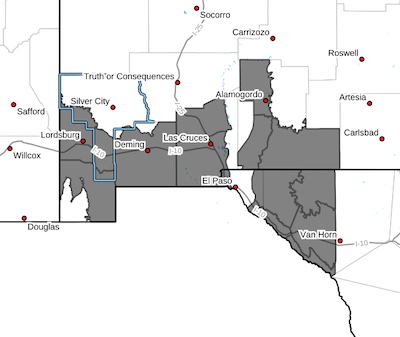
 Southwest Desert/Lower Gila River Valley-Lowlands of the Bootheel- Southwest Desert/Mimbres Basin-Northern Dona Ana County-Southern Dona Ana County/Mesilla Valley-Otero Mesa-East Central Tularosa
Basin/Alamogordo-Southeast Tularosa Basin-Western El Paso County-Northern Hudspeth Highlands/Hueco Mountains-Salt Basin-Southern
Hudspeth Highlands-Rio Grande Valley of Eastern El Paso/Western Hudspeth Counties-Rio Grande Valley of Eastern Hudspeth County-Including the cities of Antelope Wells, Deming, Holloman AFB,
Indian Hot Springs, Hachita, Columbus, Loma Linda, Lordsburg,Tularosa, Salt Flat, Animas, Garfield, Fabens, Radium Springs, Las Cruces, Fort Hancock, Vado, Downtown El Paso, Hueco Tanks,
Orogrande, Dell City, Tornillo, Sunland Park, Crow Flats,
Alamogordo, Sierra Blanca, Hatch, Upper Valley, Red Rock, Virden,
West El Paso, and Cornudas
154 PM MST Thu Feb 13 2025
...BLOWING DUST ADVISORY IN EFFECT FROM 11 AM TO 8 PM MST FRIDAY...
* WHAT...Visibility between one-quarter and one mile in blowing dust
expected.
* WHERE...Portions of south central and southwest New Mexico and
southwest Texas.
* WHEN...From 11 AM to 8 PM MST Friday.
* IMPACTS...Hazardous driving conditions due to reduced visibility.
PRECAUTIONARY/PREPAREDNESS ACTIONS...
Persons with respiratory problems should stay indoors until the
storm passes. If you encounter blowing dust while driving, pull off
the road as far as possible and put your vehicle in park. Turn the
lights all the way off and keep foot off the brake pedal. Remember,
'Pull Aside, Stay Alive'.


