

 Click to Search
Search
[{{{type}}}] {{{reason}}}
{{/data.error.root_cause}}
{{{_source.title}}} {{#_source.showPrice}} {{{_source.displayPrice}}} {{/_source.showPrice}}
{{#_source.showLink}} {{/_source.showLink}} {{#_source.showDate}}{{{_source.displayDate}}}
{{/_source.showDate}}{{{_source.description}}}
{{#_source.additionalInfo}}{{#_source.additionalFields}} {{#title}} {{{label}}}: {{{title}}} {{/title}} {{/_source.additionalFields}}
{{/_source.additionalInfo}}
Weather
- Category: Weather
ROAD ADVISORY
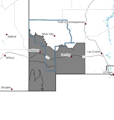
Difficult Driving Conditions in Tyrone Area
Difficult Driving Conditions, NM 90 northbound and southbound from mile marker 44, Silver City to mile marker 25, White Signal. Roads are snow packed and icy.
Silver City Area D1 - Road Advisory - Wet, light snow and may become icy overnight
- Category: Weather
Attached is a Situational Awareness Briefing for this weekends winter weather:
• Forecast has trended colder
• Snow totals in the Sacramento Mountains are a little higher
• Lowland snow has moved a little further west to include El Paso and T or C
V• ery low wind chill values expected Sunday and Monday mornings.
- Category: Weather
ROAD ADVISORY
ALERT-Deming Area
Alert, US 180 and Railroad Rd underpass is flooded. Crews are on site pumping water, seek alternate route.
- Category: Weather
Attached is an updated Situational Awareness Briefing (Jan. 22, 2026) for expected winter weather hazards this weekend:
• Widespread (90-100% chance) lowland rain showers and mountain snow beginning late tonight/Friday morning.
• A mix of rain and snow for the mountains to start, transitioning to all snow on Saturday. The onset of the Winter Storm Watch for the Sacramento Mountains has been pushed to Saturday morning. No other winter products have been issued.
• Decreasing threat of wintry weather for the lowlands, especially along the Rio Grande Valley, as the cold front struggles to progress westward.
From Jan. 21, 2026 Forecast Summary:
- Category: Weather
A G4 (Severe) Geomagnetic Storm may impact critical infrastructure around New Mexico. The Space Weather Prediction Center (SWPC) issued an alert at 5:27 a.m. ET for a G4 geomagnetic storm. The SWPC projects that any potential impacts could last from six hours up to a day. More information can be found in the situational awareness bulletin below.

Synopsis: NMASIC has been made aware of a G4 (Severe) Geomagnetic Storm that may impact critical infrastructure around New Mexico. The Space Weather Prediction Center (SWPC) issued an alert at 5:27 a.m. ET for a G4 geomagnetic storm. Since then, additional alerts have been issued between the G3 and G4 levels with impacted areas fluctuating between poleward of 45- and 50-degrees geomagnetic latitude. The SWPC projects that any potential impacts could last from six hours up to a day.
- Category: Weather
NM 35 northbound and southbound from mile marker 11, 11 miles north of NM 152 to mile marker 27, 0.5 miles south of NM 15, is clear and removed from NMRoads.
ROAD ADVISORY
DIFFICULT DRIVING CONDITIONS: Silver City Area
Difficult Driving Conditions, NM 15 northbound and southbound from mile marker 6, 1 mile south of Pinos Altos to mile marker 25, 14 miles south of Gila Hot Springs, roads are icy in spots. Please drive with caution, reduce speed, and obey all posted traffic signs. The NMDOT will continue to monitor roadways. This event will be updated as conditions change.
DIFFICULT DRIVING CONDITIONS: Silver City Area
- Category: Weather
 Southwest Desert/Lower Gila River Valley-Lowlands of the Bootheel-
Uplands of the Bootheel-Southwest Desert/Mimbres Basin-
Including the cities of Antelope Wells, Columbus, Red Rock,
Hachita, Cloverdale, Deming, Virden, Lordsburg, and Animas
1023 AM MST Sat Jan 10 2026
...COLD WEATHER ADVISORY IN EFFECT FROM 11 PM THIS EVENING TO 9 AM MST SUNDAY..
* WHAT...Very cold wind chills of 10 to 15 degrees expected.
* WHERE...Far Southwest New Mexico.
* WHEN...From 11 PM this evening to 9 AM MST Sunday.
* IMPACTS...Frostbite and hypothermia will occur if unprotected skin
is exposed to these temperatures.
- Category: Weather
ROAD ADVISORY
DIFFICULT DRIVING CONDITIONS: Silver City Area
Difficult Driving Conditions, NM 15 northbound and southbound from mile marker 6, 1 mile south of Pinos Altos to mile marker 25, 14 miles south of Gila Hot Springs, roads are slushy, snow packed and icy in spots. Please drive with caution, reduce speed, and obey all posted traffic signs. The NMDOT will continue to monitor roadways. This event will be updated as conditions change.
DIFFICULT DRIVING CONDITIONS: Silver City Area
Difficult Driving Conditions, NM 152 eastbound and westbound from mile marker 23, 8 miles east of San Lorenzo to mile marker 40, Kingston, .roads are slushy, snow packed and icy in spots. Please drive with caution, reduce speed, and obey all posted traffic signs. The NMDOT will continue to monitor roadways. This event will be updated as conditions change.
DIFFICULT DRIVING CONDITIONS: Silver City Area
Difficult Driving Conditions, NM 35 northbound and southbound from mile marker 11, 11 miles north of NM 152 to mile marker 27, 0.5 miles south of NM 15, roads are slushy, snow packed and icy in spots. Please drive with caution, reduce speed, and obey all posted traffic signs. The NMDOT will continue to monitor roadways. This event will be updated as conditions change.


Content on the Beat
WARNING: All articles and photos with a byline or photo credit are copyrighted to the author or photographer. You may not use any information found within the articles without asking permission AND giving attribution to the source. Photos can be requested and may incur a nominal fee for use personally or commercially.
Disclaimer: If you find errors in articles not written by the Beat team but sent to us from other content providers, please contact the writer, not the Beat. For example, obituaries are always provided by the funeral home or a family member. We can fix errors, but please give details on where the error is so we can find it. News releases from government and non-profit entities are posted generally without change, except for legal notices, which incur a small charge.
NOTE: If an article does not have a byline, it was written by someone not affiliated with the Beat and then sent to the Beat for posting.
Images: We have received complaints about large images blocking parts of other articles. If you encounter this problem, click on the title of the article you want to read and it will take you to that article's page, which shows only that article without any intruders.
New Columnists: The Beat continues to bring you new columnists. And check out the old faithfuls who continue to provide content.
Newsletter: If you opt in to the Join GCB Three Times Weekly Updates option above this to the right, you will be subscribed to email notifications with links to recently posted articles.
Editor's Notes
It has come to this editor's attention that people are sending information to the Grant County Beat Facebook page. Please be aware that the editor does not regularly monitor the page. If you have items you want to send to the editor, please send them to editor@grantcountybeat.com. Thanks!
Here for YOU: Consider the Beat your DAILY newspaper for up-to-date information about Grant County. It's at your fingertips! One Click to Local News. Thanks for your support for and your readership of Grant County's online news source—www.grantcountybeat.com
Feel free to notify editor@grantcountybeat.com if you notice any technical problems on the site. Your convenience is my desire for the Beat. The Beat totally appreciates its readers and subscribers!
Compliance: Because you are an esteemed member of The Grant County Beat readership, be assured that we at the Beat continue to do everything we can to be in full compliance with GDPR and pertinent US law, so that the information you have chosen to give to us cannot be compromised.
Submitting to the Beat
Those new to providing news releases to the Beat are asked to please check out submission guidelines at https://www.grantcountybeat.com/about/submissions. They are for your information to make life easier on the readers, as well as for the editor.
Advertising: Don't forget to tell advertisers that you saw their ads on the Beat.
Classifieds: We have changed Classifieds to a simpler option. Check periodically to see if any new ones have popped up. Send your information to editor@grantcountybeat.com and we will post it as soon as we can. Instructions and prices are on the page.