


 Flash Flood Warning
National Weather Service El Paso Tx/Santa Teresa NM
1240 PM MDT Thu Jun 26 2025
The National Weather Service in El Paso Tx/Santa Teresa has issued a
* Flash Flood Warning for...
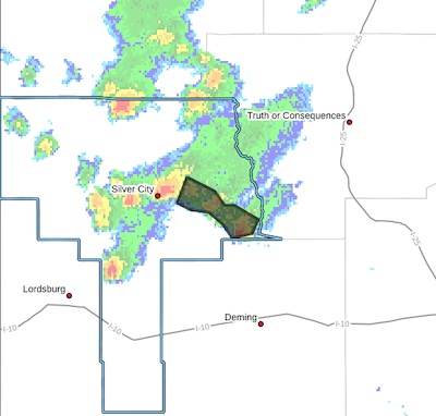
East Central Grant County in southwestern New Mexico...
* Until 245 PM MDT.
* At 1240 PM MDT, Doppler radar indicated thunderstorms producing
heavy rain across the warned area. Between 1 and 1.5 inches of
rain have fallen. Additional rainfall amounts up to 1 inch are possible in the warned area. Flash flooding is ongoing or expected to begin shortly.
HAZARD...Flash flooding caused by thunderstorms.
SOURCE...Radar.
IMPACT...Flash flooding of small creeks and streams, urban
areas, highways, streets and underpasses as well as
other poor drainage and low-lying areas.
* Some locations that will experience flash flooding include...
Faywood, Sherman, Cobre, Bayard, Hanover, Fierro and Santa Clara.
PRECAUTIONARY/PREPAREDNESS ACTIONS...
Turn around, don't drown when encountering flooded roads. Most flood
deaths occur in vehicles.
Be aware of your surroundings and do not drive on flooded roads.
Flooding is occurring or is imminent. It is important to know where
you are relative to streams, rivers, or creeks which can become
killers in heavy rains. Campers and hikers should avoid streams or
creeks.


