


 Upper Gila River Valley-Southern Gila Foothills/Mimbres Valley-
Eastern Black Range Foothills-West Slopes Sacramento Mountains
Below 7500 Feet-Sacramento Mountains Above 7500 Feet-East Slopes
Sacramento Mountains Below 7500 Feet-Central Grant County/Silver
City Area-Southern Gila Region Highlands/Black Range-
Including the cities of Hurley, Faywood, Grant County Airport,
Kingston, Winston, Timberon, Silver City, Buckhorn, Lake Roberts,
Gila Hot Springs, Apache Summit, Sunspot, Sacramento, Cliff,
Mayhill, Mule Creek, Cloudcroft, Mimbres, Mescalero, Hillsboro,
Mountain Park, Pinon, and Fort Bayard
210 PM MDT Sat Jul 20 2024
...FLOOD WATCH IN EFFECT FROM SUNDAY AFTERNOON THROUGH LATE SUNDAY
NIGHT...
* WHAT...Flash flooding caused by excessive rainfall is possible.
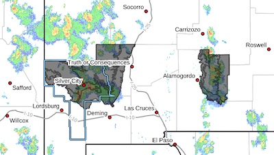
* WHERE...Portions of south central and southwest New Mexico,
including the following areas, in south central New Mexico, East
Slopes Sacramento Mountains Below 7500 Feet, Sacramento Mountains
Above 7500 Feet and West Slopes Sacramento Mountains Below 7500
Feet. In southwest New Mexico, Central Grant County/Silver City
Area, Eastern Black Range Foothills, Southern Gila
Foothills/Mimbres Valley, Southern Gila Region Highlands/Black
Range and Upper Gila River Valley.
* WHEN...From Sunday afternoon through late Sunday night.
* IMPACTS...Excessive runoff may result in flooding of rivers,
creeks, streams, and other low-lying and flood-prone locations.
Low-water crossings may be flooded. Extensive street flooding and
flooding of creeks and rivers are possible.
* ADDITIONAL DETAILS...
- Moist atmospheric conditions will persist over the region
with slow moving and training storms producing heavy rainfall
with a potential for flash flooding along drainages and
streams.
- http://www.weather.gov/safety/flood
PRECAUTIONARY/PREPAREDNESS ACTIONS...
You should monitor later forecasts and be prepared to take action
should Flash Flood Warnings be issued.
&&
...FLOOD WATCH REMAINS IN EFFECT THROUGH LATE TONIGHT...
* WHAT...Flash flooding caused by excessive rainfall continues to be
possible.
* WHERE...Portions of south central and southwest New Mexico,
including the following areas, in south central New Mexico, East
Slopes Sacramento Mountains Below 7500 Feet, Sacramento Mountains
Above 7500 Feet and West Slopes Sacramento Mountains Below 7500
Feet. In southwest New Mexico, Central Grant County/Silver City
Area, Eastern Black Range Foothills, Southern Gila
Foothills/Mimbres Valley, Southern Gila Region Highlands/Black
Range and Upper Gila River Valley.
* WHEN...Through late tonight.
* IMPACTS...Excessive runoff may result in flooding of rivers,
creeks, streams, and other low-lying and flood-prone locations.
Low-water crossings may be flooded. Area creeks and streams are
running high and could flood with more heavy rain.
* ADDITIONAL DETAILS...
- Moist atmospheric conditions will persist over the region
with slow moving and training storms producing heavy rainfall
with a potential for flash flooding along drainages and
streams. recent wildfire burn scars will be particularly
sensitive to lesser rain amounts with flash flooding and
debris flows.
- http://www.weather.gov/safety/flood
PRECAUTIONARY/PREPAREDNESS ACTIONS...
You should monitor later forecasts and be prepared to take action
should Flash Flood Warnings be issued.


